
#30DayMapChallenge: Earth
The top "Earth" maps from Day 5, featuring global forests, soil carbon, and planetary relationships.
Today's maps took us from the highest peaks to the deepest soils, showing Earth's incredible stories through data. Here are my favourite five from the Earth theme:
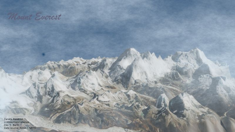
5. Žaneta Piasecka – Mount Everest Terrain Model
A breathtaking 3D view of Everest, created in Blender - especially impressive as her first time using the software.
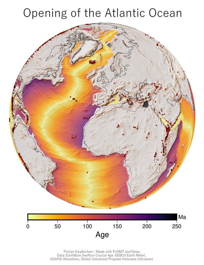
4. Florian Neukirchen – Atlantic Ocean Opening
A geological timeline showing how the Atlantic sea floor has spread over millions of years, with active volcanoes marking the boundaries.
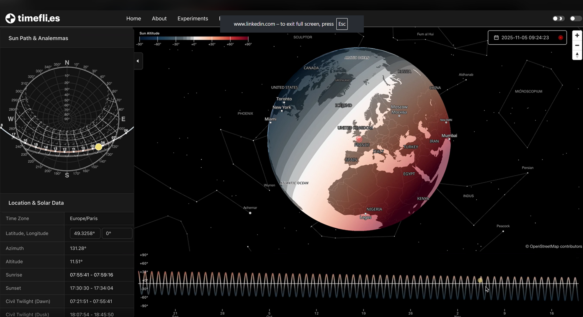
3. Julien Colot – Earth's Twilight Zones
An interactive globe showing Earth's relationship with the Sun, Moon, and stars - visualising daylight, night, and twilight zones throughout history.
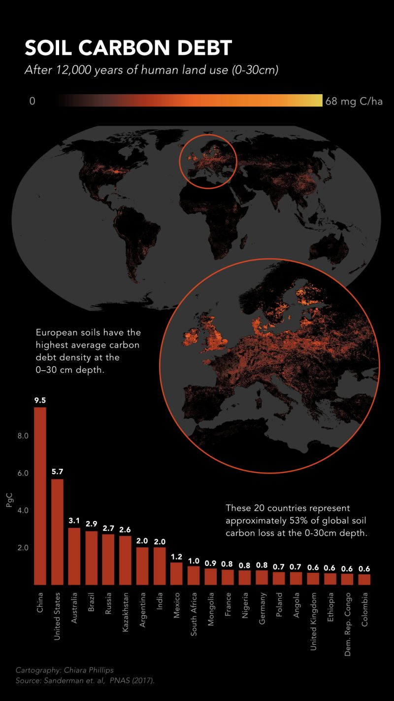
2. Chiara Phillips – Soil Carbon Debt
A powerful map showing how 12,000 years of human land use has depleted soil carbon across continents.
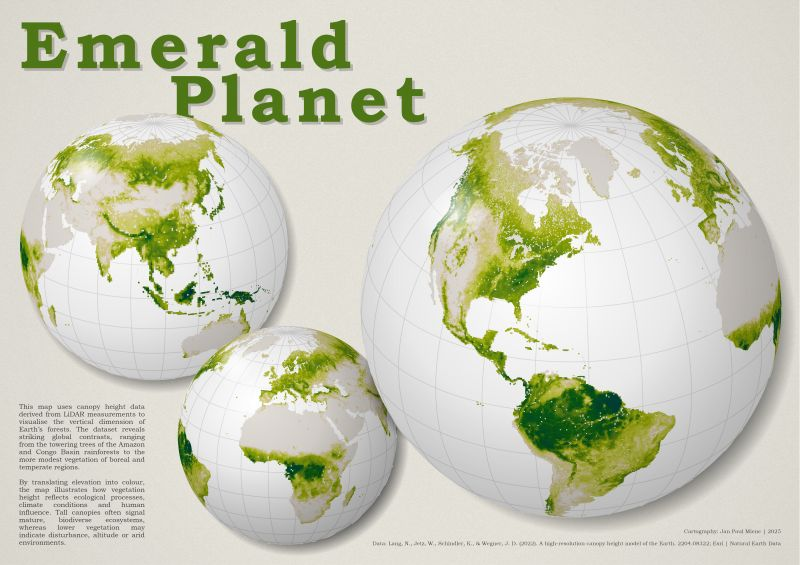
1. Jan Paul Miene – Global Forest Canopy Height
My favorite - a beautiful "Emerald Planet" visualisation showing forest heights worldwide, from Amazon giants to northern woodlands.
These maps remind us how cartography can reveal both the beauty and science of our home planet.
Which Earth map resonated most with you today?


Comments ()